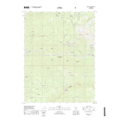
2018 Map of Sierra City
USGS Topo · Published 2018About this map
Sierra City and Loganville anchor this high-altitude landscape within the Tahoe National Forest, where the N Yuba River cuts through the steep canyons of the northern Sierra Nevada. The terrain is marked by a complex network of OHV trails and historic mining access roads, including the Monarch Mine Rd and Columbo Mine Rd, reflecting the region's enduring connection to extraction and recreation. Notable alpine features such as the Sierra Buttes and the Pacific Crest National Scenic Trail dominate the eastern heights, while numerous glacial lakes like Upper Sardine Lake and Young America Lake are tucked into the granite basins. The southern portion of the map traces the Sierra Co and Nevada Co boundary across the Middle Yuba River, highlighting the isolated settlements of Gold Valley and China Flat situated amidst numerous ravines and mountain peaks.
Find a feature on this map
66 named features on this map. Tap any name to fly to it.
Don’t see what you’re looking for? This feature index may not catch every label — zoom into the map to look around manually.
Map Details
Editions of this 2018 Sierra City Map
This is the sole edition of this map. No revisions or reprints were ever made.
Other maps of this area

1891 · Downieville
USGS Topo · 1:125,000

1891 · Colfax
USGS Topo · 1:125,000

1892 · Colfax
USGS Topo · 1:125,000

1893 · Downieville
USGS Topo · 1:125,000

1894 · Colfax
USGS Topo · 1:125,000

1895 · Downieville
USGS Topo · 1:125,000

1896 · Downieville
USGS Topo · 1:125,000

1897 · Downieville
USGS Topo · 1:125,000

1898 · Colfax
USGS Topo · 1:125,000

1900 · Colfax
USGS Topo · 1:125,000