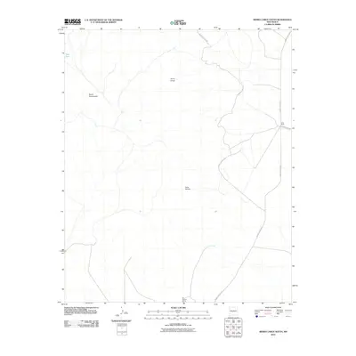
2010 Map of Sierra Larga South
USGS Topo · Published 2010About this map
The high desert terrain of Socorro County is defined by the massive upland of Sierra Larga, which dominates this 2010 survey. To the west, the sharp incline of Bordo Atravesado rises over the landscape, while Cerro Venado sits further south. Human presence in this arid environment is sparsely marked by essential water sources and specialized ranching operations. The Long Ranch is located on the eastern edge of the quadrangle, connected by several White Sands Missile Range (WSMR) routes. These government-maintained roads, such as WSMR S Route 3817, crisscross the area, providing access to remote outposts and vital springs like Coyote Spring and San Antonio Spring. The map documents a landscape where traditional ranching life and modern military infrastructure overlap.
Find a feature on this map
10 named features on this map. Tap any name to fly to it.
Don’t see what you’re looking for? This feature index may not catch every label — zoom into the map to look around manually.
Map Details
Editions of this 2010 Sierra Larga South Map
This is the sole edition of this map. No revisions or reprints were ever made.
Other maps of this area

1916 · La Joya
USGS Topo · 1:125,000

1918 · Oscura Peak
USGS Topo · 1:125,000

1948 · Carthage
USGS Topo · 1:62,500

1948 · Bingham
USGS Topo · 1:62,500

1954 · Tularosa
USGS Topo · 1:250,000

1954 · Socorro
USGS Topo · 1:250,000

1958 · Socorro
USGS Topo · 1:250,000

1958 · Tularosa
USGS Topo · 1:250,000

1962 · Socorro
USGS Topo · 1:250,000
1972 · Sierra Larga North
USGS Topo · 1:24,000