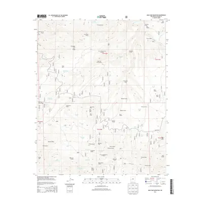
2013 Map of Sign Camp Mountain
USGS Topo · Published 2013About this map
The Mogollon Divide creates a prominent topographical spine across this section of the Gila National Forest in Catron County. This landscape is defined by its complex network of seasonal water storage and drainage systems, where livestock and wildlife management is evident through numerous named tanks such as Bear Tank, Six-shooter Tank, and the Upper Devils Tank. The high-elevation terrain is segmented by significant ridges and summits, including Sign Camp Mtn, Turkey Mtn, and Blackdeer Ridge, with the Rainy Mesa plateau providing a distinct upland area. Historically relevant water sources for explorers and ranchers appear as Old Cabin Spring and Oak Spring. This 2013 survey records the remote forest road network, specifically Forest Rd 180 and Forest Rd 181, which traverse the steep canyons and divides that characterize this interior portion of the New Mexico high country.
Find a feature on this map
67 named features on this map. Tap any name to fly to it.
Don’t see what you’re looking for? This feature index may not catch every label — zoom into the map to look around manually.
Map Details
Editions of this 2013 Sign Camp Mountain Map
This is the sole edition of this map. No revisions or reprints were ever made.
Other maps of this area

1910 · Mogollon
USGS Topo · 1:125,000

1912 · Mogollon
USGS Topo · 1:125,000

1915 · Reserve
USGS Topo · 1:125,000

1918 · Reserve
USGS Topo · 1:125,000

1954 · Clifton
USGS Topo · 1:250,000

1957 · Clifton
USGS Topo · 1:250,000

1958 · Clifton
USGS Topo · 1:250,000

1962 · Clifton
USGS Topo · 1:250,000

1963 · Bearwallow Mountain
USGS Topo · 1:24,000

1963 · Negrito Mountain
USGS Topo · 1:24,000