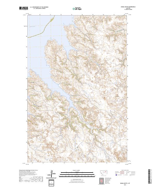
2024 Map of Signal Butte
USGS Topo · Published 2024About this map
The Charles M Russell National Wildlife Refuge dominates this section of Garfield County, Montana, protecting the complex system of coulees and breaks draining into the Missouri River. The landscape is defined by its intricate hydrography, where seasonal and permanent waterways like Bog Coulee, Bunn Coulee, and White Horse Coulee have carved deep incisions through the high plains. These drainage patterns converge toward the East Fork Crooked Creek and Cattle Creek systems, illustrating the erosion-driven topography characteristic of this part of the state.
Find a feature on this map
19 named features on this map. Tap any name to fly to it.
Don’t see what you’re looking for? This feature index may not catch every label — zoom into the map to look around manually.
Map Details
Editions of this 2024 Signal Butte Map
This is the sole edition of this map. No revisions or reprints were ever made.
Other maps of this area

1954 · Jordan
USGS Topo · 1:250,000

1956 · Jordan
USGS Topo · 1:250,000

1958 · Jordan
USGS Topo · 1:250,000

1958 · Collins Ranch
USGS Topo · 1:62,500

1958 · Maloney Hill
USGS Topo · 1:62,500

1958 · Sage Creek Point
USGS Topo · 1:24,000
1958 · Seventh Point Buttes
USGS Topo · 1:24,000

1964 · Jordan
USGS Topo · 1:250,000
1972 · Kester School
USGS Topo · 1:24,000
1972 · Gilbert Creek SE
USGS Topo · 1:24,000