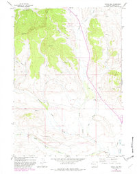
1966 Map of Signal Hill
USGS Topo · Published 1982About this map
Signal Hill stands as the central topographic feature in this mid-1960s survey of the Wyoming high country, where the landscape is defined by a complex drainage network and early industrial footprints. The area is marked by significant hydrological management, evidenced by the Lena Ditch and Horsefly Ditch which cut across the eastern slopes to direct water through the arid terrain. To the north and west, the dramatic elevations of the East Rim and South Rim overlook a series of deep cuts including Watson Draw and Annie Draw. Evidence of mid-century resource exploration appears in the form of a Gas Well and a Drill Hole, tucked between the winding paths of North Beaver Creek and Middle Cow Gulch. This period shows the transition of the Sublette County backcountry into a managed landscape of water rights and energy development.
Find a feature on this map
23 named features on this map. Tap any name to fly to it.
Don’t see what you’re looking for? This feature index may not catch every label — zoom into the map to look around manually.
Map Details
Editions of this 1966 Signal Hill Map
2 editions found
Other maps of this area

1907 · Gros Ventre
USGS Topo · 1:125,000

1910 · Gros Ventre
USGS Topo · 1:125,000

1939 · Big Piney
USGS Topo · 1:125,000

1942 · Big Piney
USGS Topo · 1:125,000

1955 · Driggs
USGS Topo · 1:250,000

1955 · Preston
USGS Topo · 1:250,000

1958 · Driggs
USGS Topo · 1:250,000

1958 · Preston
USGS Topo · 1:250,000

1962 · Driggs
USGS Topo · 1:250,000

1962 · Preston
USGS Topo · 1:250,000