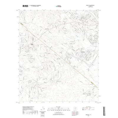
2019 Map of Signal Hill
USGS Topo · Published 2019About this map
Slaughter Cr and Bear Cr carve through the limestone landscape of the Balcones Escarpment, defining the rugged geography at the western edge of Austin. This 2019 survey captures the transition from established hill country settlements like Cedar Valley to the suburban expansion stretching from Dripping Springs. Significant topographic landmarks such as Signal Hill and Friday Mtn rise above the drainage basins of Williamson Cr and Little Bear Cr, marking a region historically characterized by ranching and small-scale farming. Local family histories are anchored by features like Oliver Cem and Johnson Cem, which sit alongside historic road corridors like Fitzhugh Rd and Sawyer Ranch Rd, providing a detailed record of the area's rural roots and its contemporary residential evolution.
Find a feature on this map
250 named features on this map. Tap any name to fly to it.
Don’t see what you’re looking for? This feature index may not catch every label — zoom into the map to look around manually.
Map Details
Editions of this 2019 Signal Hill Map
This is the sole edition of this map. No revisions or reprints were ever made.
Other maps of this area

1887 · Blanco
USGS Topo · 1:125,000

1894 · Blanco
USGS Topo · 1:125,000

1896 · Austin
USGS Topo · 1:125,000

1897 · Austin
USGS Topo · 1:125,000

1910 · Austin
USGS Topo · 1:125,000

1932 · Mt. Bonnell
USGS Topo · 1:62,500

1954 · Austin West
USGS Topo · 1:24,000

1954 · Llano
USGS Topo · 1:250,000

1954 · Austin
USGS Topo · 1:250,000

1955 · Llano
USGS Topo · 1:250,000