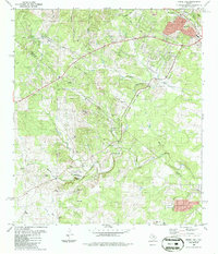
1986 Map of Signal Hill
USGS Topo · Published 1986About this map
Cedar Valley and the southwestern edge of Austin meet along the ridge lines of central Texas in this 1986 revision. The landscape is defined by the headwaters of numerous waterways, including Williamson Creek, Slaughter Creek, and Bear Creek, which carve through the limestone terrain toward the southeast. The map documents the rural-to-suburban transition as the Austin corporate boundary pushes into former ranch lands, yet several historic markers remain. Genealogists and local historians will find the Oliver Cem and Johnson Cem preserved amidst the hills, along with community focal points like Friendship Ch and the Boys Camp near Friday Mountain. From the elevated Signal Hill Radio Tower to the small pockets of resource extraction at various Gravel Pits, the map captures the region's topographical complexity and shifting land use patterns during the mid-1980s.
Find a feature on this map
30 named features on this map. Tap any name to fly to it.
Don’t see what you’re looking for? This feature index may not catch every label — zoom into the map to look around manually.
Map Details
Editions of this 1986 Signal Hill Map
2 editions found
Other maps of this area

1887 · Blanco
USGS Topo · 1:125,000

1894 · Blanco
USGS Topo · 1:125,000

1896 · Austin
USGS Topo · 1:125,000

1897 · Austin
USGS Topo · 1:125,000

1910 · Austin
USGS Topo · 1:125,000

1932 · Mt. Bonnell
USGS Topo · 1:62,500

1954 · Austin West
USGS Topo · 1:24,000

1954 · Llano
USGS Topo · 1:250,000

1954 · Austin
USGS Topo · 1:250,000

1955 · Llano
USGS Topo · 1:250,000