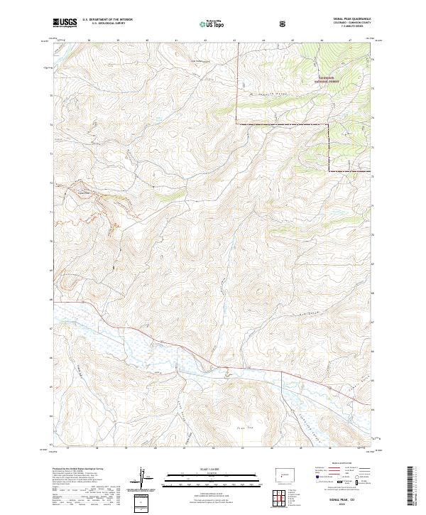
2022 Map of Signal Peak
USGS Topo · Published 2022About this map
Gunnison National Forest land dominates the northeastern corner of this region, where the Sawatch Range rises above the drainage of Cabin Cr. The landscape is a complex network of high mesas and deep gulches, characterized by the prominent summit of Signal Peak and the sprawling Flat Top plateau to the south. Modern recreational access is well-documented through an extensive trail system including the Signal Mesa East Trl and Duane's World Trl.
Find a feature on this map
42 named features on this map. Tap any name to fly to it.
Don’t see what you’re looking for? This feature index may not catch every label — zoom into the map to look around manually.
Map Details
Editions of this 2022 Signal Peak Map
This is the sole edition of this map. No revisions or reprints were ever made.
Other maps of this area

1941 · Pitkin
USGS Topo · 1:62,500

1945 · Pitkin
USGS Topo · 1:62,500

1954 · Iris NW
USGS Topo · 1:24,000

1954 · Gunnison
USGS Topo · 1:24,000

1956 · Montrose
USGS Topo · 1:250,000

1959 · Montrose
USGS Topo · 1:250,000

1960 · Montrose
USGS Topo · 1:250,000

1962 · Iris
USGS Topo · 1:24,000

1962 · Houston Gulch
USGS Topo · 1:24,000
1964 · Flat Top
USGS Topo · 1:24,000