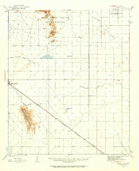
1922 Map of Signal Peak
USGS Topo · Published 1960About this map
The Gila River Indian Reservation occupies the northern reaches of this Pinal County landscape, where the Sacaton Mountains rise sharply above the desert floor. The survey highlights early 20th-century water management efforts, specifically the Casa Grande Florence Canal, which cuts across the central plains toward established railroad settlements. Along the Southern Pacific tracks, the towns of Arizola, Toltec, and Eloy serve as vital hubs for the local agricultural and mining economy, including the remote American Boy Mine tucked near the Casa Grande Mountains. This era of development is further evidenced by several rural schoolhouses, such as Selma School and Pinal School, which provided community anchors for families settled near the North Branch Santa Cruz Wash and Mc Clellan Wash.
Find a feature on this map
20 named features on this map. Tap any name to fly to it.
Don’t see what you’re looking for? This feature index may not catch every label — zoom into the map to look around manually.
Map Details
Editions of this 1922 Signal Peak Map
2 editions found
Other maps of this area

1900 · Florence
USGS Topo · 1:125,000

1902 · Florence
USGS Topo · 1:125,000

1907 · Sacaton
USGS Topo · 1:62,500

1914 · Gila Butte
USGS Topo · 1:62,500

1917 · Gila Butte
USGS Topo · 1:62,500

1922 · Red Rock No 2
USGS Topo · 1:48,000

1922 · Casa Grande
USGS Topo · 1:62,500

1922 · Signal Peak
USGS Topo · 1:62,500

1924 · Signal Peak
USGS Topo · 1:62,500

1924 · Casa Grande
USGS Topo · 1:62,500