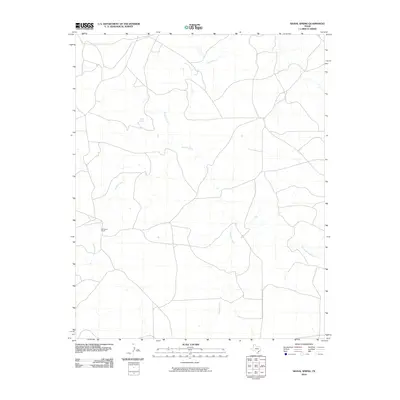
2010 Map of Signal Spring
USGS Topo · Published 2010About this map
Signal Spring serves as a focal point in this portion of Oldham County, where the topography is defined by the complex drainage systems of the Texas Panhandle. The landscape is carved by the winding paths of Trujillo Creek and Mujares Creek, which create a network of draws across the terrain. These water sources have historically dictated the placement of ranching operations in this arid environment, evidenced by the presence of Windham Ranch. The map illustrates a contemporary view of this rural landscape, showing how modern road networks and land boundaries continue to follow the natural contours and riparian corridors like the East Fork Mujares Creek. This survey captures the sparse but vital infrastructure of the high plains, where isolated springs and named ranches remain the primary landmarks for local geography and genealogy.
Find a feature on this map
5 named features on this map. Tap any name to fly to it.
Don’t see what you’re looking for? This feature index may not catch every label — zoom into the map to look around manually.
Map Details
Editions of this 2010 Signal Spring Map
This is the sole edition of this map. No revisions or reprints were ever made.
Other maps of this area

1954 · Tucumcari
USGS Topo · 1:250,000

1958 · Tucumcari
USGS Topo · 1:250,000

1966 · Moser Ranch
USGS Topo · 1:24,000

1966 · Signal Spring
USGS Topo · 1:24,000

1966 · Boise
USGS Topo · 1:24,000

1966 · Signal Spring SE
USGS Topo · 1:24,000

1966 · Vat Camp
USGS Topo · 1:24,000

1966 · Trujillo Camp
USGS Topo · 1:24,000

1968 · Glenrio
USGS Topo · 1:24,000

1968 · Sanchez Springs
USGS Topo · 1:24,000