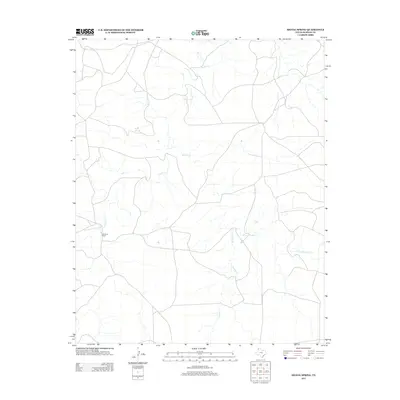
2012 Map of Signal Spring
USGS Topo · Published 2012About this map
Signal Spring serves as a central landmark in this portion of Oldham County, where the high plains of the Texas Panhandle are defined by a complex network of intermittent drainage. The landscape is characterized by the branching paths of Trujillo Cr in the north and the upper reaches of Mujares Cr and the E Fork Mujares Cr to the south. This area represents a classic ranching environment, anchored by the Windham Ranch, illustrating the sparse but deliberate human imprint on this semi-arid terrain.
Find a feature on this map
5 named features on this map. Tap any name to fly to it.
Don’t see what you’re looking for? This feature index may not catch every label — zoom into the map to look around manually.
Map Details
Editions of this 2012 Signal Spring Map
This is the sole edition of this map. No revisions or reprints were ever made.
Other maps of this area

1954 · Tucumcari
USGS Topo · 1:250,000

1958 · Tucumcari
USGS Topo · 1:250,000

1966 · Moser Ranch
USGS Topo · 1:24,000

1966 · Signal Spring
USGS Topo · 1:24,000

1966 · Boise
USGS Topo · 1:24,000

1966 · Signal Spring SE
USGS Topo · 1:24,000

1966 · Vat Camp
USGS Topo · 1:24,000

1966 · Trujillo Camp
USGS Topo · 1:24,000

1968 · Glenrio
USGS Topo · 1:24,000

1968 · Sanchez Springs
USGS Topo · 1:24,000