
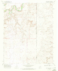
1966 Map of Signal Spring
USGS Topo · Published 1968About this map
Trujillo Creek carves a winding path through this corner of the Texas Panhandle, defining a landscape of deep draws and high plains in Oldham County. The mid-1960s survey documents a region dominated by large-scale ranching operations and natural water sources, essential for survival in this arid environment. The presence of the Windham Ranch illustrates the persistence of cattle heritage in the area, while Signal Spring stands as a named landmark for early travelers and locals alike. Drainage systems like Mujares Creek and the East Fork provide the primary topographic relief, showing the intricate erosion patterns characteristic of the Canadian River watershed. This study focuses on the quiet, rural character of the high plains before further modernization of the surrounding road networks.
Find a feature on this map
5 named features on this map. Tap any name to fly to it.
Don’t see what you’re looking for? This feature index may not catch every label — zoom into the map to look around manually.
Map Details
Editions of this 1966 Signal Spring Map
This is the sole edition of this map. No revisions or reprints were ever made.
Other maps of this area

1954 · Tucumcari
USGS Topo · 1:250,000

1958 · Tucumcari
USGS Topo · 1:250,000

1966 · Moser Ranch
USGS Topo · 1:24,000

1966 · Boise
USGS Topo · 1:24,000

1966 · Signal Spring SE
USGS Topo · 1:24,000

1966 · Vat Camp
USGS Topo · 1:24,000

1966 · Trujillo Camp
USGS Topo · 1:24,000

1968 · Glenrio
USGS Topo · 1:24,000

1968 · Sanchez Springs
USGS Topo · 1:24,000
1968 · Martin Draw
USGS Topo · 1:24,000