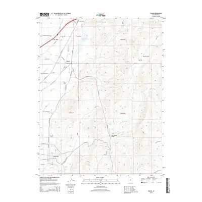
2014 Map of Sigurd
USGS Topo · Published 2014About this map
Glenwood and Sigurd sit within a landscape defined by an intricate network of irrigation and water management, where the Sevier River valley supports a series of canals including the Piute Canal, Richfield Canal, and Vermillion Canal. The 2014 survey reveals how the local topography, featuring landmarks like Black Knoll and the Rainbow Hills, dictates the placement of settlements and transport routes. Genealogy researchers will find several local burial sites documented, such as Glenwood Cem, Sigurd Cem, and Venice Cem. To the east, the terrain rises into Kings Meadow Canyon and towards Cedar Mtn, contrasting the developed river valley with more complex upland drainage systems like Peterson Cr. The presence of the Rocky Ford Reservoir further illustrates the region's reliance on managed water resources for its community and agricultural life.
Find a feature on this map
84 named features on this map. Tap any name to fly to it.
Don’t see what you’re looking for? This feature index may not catch every label — zoom into the map to look around manually.
Map Details
Editions of this 2014 Sigurd Map
This is the sole edition of this map. No revisions or reprints were ever made.
Other maps of this area

1885 · Beaver
USGS Topo · 1:250,000

1885 · Fish Lake
USGS Topo · 1:250,000

1896 · Fish Lake
USGS Topo · 1:250,000

1940 · Monroe
USGS Topo · 1:62,500

1944 · Monroe
USGS Topo · 1:62,500

1953 · Richfield
USGS Topo · 1:250,000

1956 · Salina
USGS Topo · 1:250,000

1958 · Richfield
USGS Topo · 1:250,000

1960 · Salina
USGS Topo · 1:250,000

1961 · Richfield
USGS Topo · 1:62,500