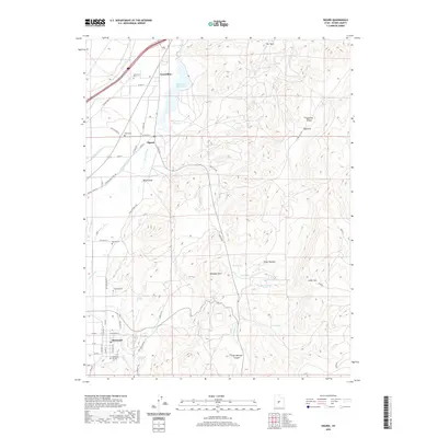
2020 Map of Sigurd
USGS Topo · Published 2020About this map
Glenwood and the neighboring settlements of Sigurd and Vermillion anchor this Sevier County landscape, where complex irrigation systems define the valley's character. The intricate network of the Piute Canal, Richfield Canal, and Vermillion Canal draws from the Sevier River and Rocky Ford Reservoir, illustrating the critical role of water management in this high-desert region. Genealogists will find significant value in the detailed plotting of local burial grounds, including the Glenwood Pioneer Cem, Venice Cem, and Sigurd Cem. East of the river valley, the terrain rises sharply into the Rainbow Hills and Kings Meadow Canyon, leading toward Cedar Mtn. This topographic study preserves the mid-2010s road and water infrastructure, from the rural reaches of Sage Flat Rd to the concentrated residential blocks and springs that supported these historic communities.
Find a feature on this map
63 named features on this map. Tap any name to fly to it.
Don’t see what you’re looking for? This feature index may not catch every label — zoom into the map to look around manually.
Map Details
Editions of this 2020 Sigurd Map
This is the sole edition of this map. No revisions or reprints were ever made.
Other maps of this area

1885 · Beaver
USGS Topo · 1:250,000

1885 · Fish Lake
USGS Topo · 1:250,000

1896 · Fish Lake
USGS Topo · 1:250,000

1940 · Monroe
USGS Topo · 1:62,500

1944 · Monroe
USGS Topo · 1:62,500

1953 · Richfield
USGS Topo · 1:250,000

1956 · Salina
USGS Topo · 1:250,000

1958 · Richfield
USGS Topo · 1:250,000

1960 · Salina
USGS Topo · 1:250,000

1961 · Richfield
USGS Topo · 1:62,500