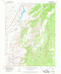
1966 Map of Sigurd
USGS Topo · Published 1969About this map
The Sevier River valley serves as a corridor for settlement and industry in this 1960s survey, where the communities of Sigurd, Glenwood, and Vermillion are interconnected by the Denver and Rio Grande Western railroad. This region is defined by its sophisticated irrigation and water management systems, including the Venice Canal, Richfield Canal, and the Piute Canal that divert water through the valley floor. Near Glenwood, the State Fish Hatchery and Glenwood Spring indicate the importance of natural water sources, while the Rocky Ford Res and its accompanying Rocky Ford Dam regulate the northern flow.
Find a feature on this map
56 named features on this map. Tap any name to fly to it.
Don’t see what you’re looking for? This feature index may not catch every label — zoom into the map to look around manually.
Map Details
Editions of this 1966 Sigurd Map
This is the sole edition of this map. No revisions or reprints were ever made.
Other maps of this area

1885 · Beaver
USGS Topo · 1:250,000

1885 · Fish Lake
USGS Topo · 1:250,000

1896 · Fish Lake
USGS Topo · 1:250,000

1940 · Monroe
USGS Topo · 1:62,500

1944 · Monroe
USGS Topo · 1:62,500

1953 · Richfield
USGS Topo · 1:250,000

1956 · Salina
USGS Topo · 1:250,000

1958 · Richfield
USGS Topo · 1:250,000

1960 · Salina
USGS Topo · 1:250,000

1961 · Richfield
USGS Topo · 1:62,500