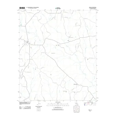
2012 Map of Sikes
USGS Topo · Published 2012About this map
The town of Sikes serves as a central hub in this section of Winn Parish, characterized by a network of rural roads and an active energy sector. The landscape is defined by its natural hydrology, including the winding courses of Turkey Creek, Flat Creek, and Spring Creek. Economic activity is evidenced by several energy tracts, such as the East Sikes Gas Field and the West Hickory Valley Gas Field. Historical and family connections are scattered across the parish, marked by numerous burial grounds including Wright Cemetery, Willis Cemetery, and Starns Cemetery. Near the settlement of Hill, the Sikes Lookout Tower stands as a prominent landmark overlooking the timber and creek bottoms. This survey documents the intersection of traditional small-town Louisiana life with the industrial footprint of the local gas fields during the early twenty-first century.
Find a feature on this map
87 named features on this map. Tap any name to fly to it.
Don’t see what you’re looking for? This feature index may not catch every label — zoom into the map to look around manually.
Map Details
Editions of this 2012 Sikes Map
This is the sole edition of this map. No revisions or reprints were ever made.
Other maps of this area

1949 · Jonesboro
USGS Topo · 1:62,500

1950 · Jonesboro
USGS Topo · 1:62,500

1950 · Winnfield
USGS Topo · 1:62,500

1951 · Winnfield
USGS Topo · 1:62,500

1953 · Alexandria
USGS Topo · 1:250,000

1954 · Sikes
USGS Topo · 1:62,500

1954 · Tullos
USGS Topo · 1:62,500

1955 · Shreveport
USGS Topo · 1:250,000

1955 · Alexandria
USGS Topo · 1:250,000

1956 · Shreveport
USGS Topo · 1:250,000