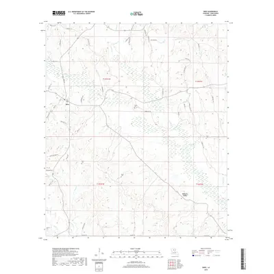
2018 Map of Sikes
USGS Topo · Published 2018About this map
The settlement of Sikes sits at the junction of local parish roads and a network of small waterways in Winn Parish. This 2018 survey reveals a landscape deeply defined by its drainage systems, including Turkey Cr, Caffey Br, and Oxpen Cr. For those tracing local families and old homesteads, the map identifies several rural burial grounds scattered across the townships, such as Wright Cem, Smith Cem, and Willis Cem. Further south, the community of Hickory Valley appears near the banks of Tanyard Cr. The intricate network of timber roads and parish routes, like Shell Rd and Fatheree Rd, suggests the ongoing importance of the local forest industry and rural connectivity in north-central Louisiana.
Find a feature on this map
64 named features on this map. Tap any name to fly to it.
Don’t see what you’re looking for? This feature index may not catch every label — zoom into the map to look around manually.
Map Details
Editions of this 2018 Sikes Map
This is the sole edition of this map. No revisions or reprints were ever made.
Other maps of this area

1949 · Jonesboro
USGS Topo · 1:62,500

1950 · Jonesboro
USGS Topo · 1:62,500

1950 · Winnfield
USGS Topo · 1:62,500

1951 · Winnfield
USGS Topo · 1:62,500

1953 · Alexandria
USGS Topo · 1:250,000

1954 · Sikes
USGS Topo · 1:62,500

1954 · Tullos
USGS Topo · 1:62,500

1955 · Shreveport
USGS Topo · 1:250,000

1955 · Alexandria
USGS Topo · 1:250,000

1956 · Shreveport
USGS Topo · 1:250,000