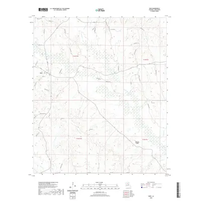
2020 Map of Sikes
USGS Topo · Published 2020About this map
Sikes serves as the primary hub of this north-central Louisiana landscape, where the local road network converges near Caney Br and Flat Cr. The terrain is defined by a dense drainage system of creeks and branches, including the prominent Turkey Cr and Fish Cr, which carve through the wooded parishes of the region. This 2020 survey documents the enduring presence of family history through several mapped burial sites, such as Wright Cem, Starns Cem, Smith Cem, and Willis Cem, often located near established parish roads. The rural community of Hickory Valley sits to the southeast, positioned between Tanyard Cr and Wheless Br. These features reflect a traditional settlement pattern where homes and cemeteries are anchored to the higher ground between the many winding waterways.
Find a feature on this map
62 named features on this map. Tap any name to fly to it.
Don’t see what you’re looking for? This feature index may not catch every label — zoom into the map to look around manually.
Map Details
Editions of this 2020 Sikes Map
This is the sole edition of this map. No revisions or reprints were ever made.
Other maps of this area

1949 · Jonesboro
USGS Topo · 1:62,500

1950 · Jonesboro
USGS Topo · 1:62,500

1950 · Winnfield
USGS Topo · 1:62,500

1951 · Winnfield
USGS Topo · 1:62,500

1953 · Alexandria
USGS Topo · 1:250,000

1954 · Sikes
USGS Topo · 1:62,500

1954 · Tullos
USGS Topo · 1:62,500

1955 · Shreveport
USGS Topo · 1:250,000

1955 · Alexandria
USGS Topo · 1:250,000

1956 · Shreveport
USGS Topo · 1:250,000