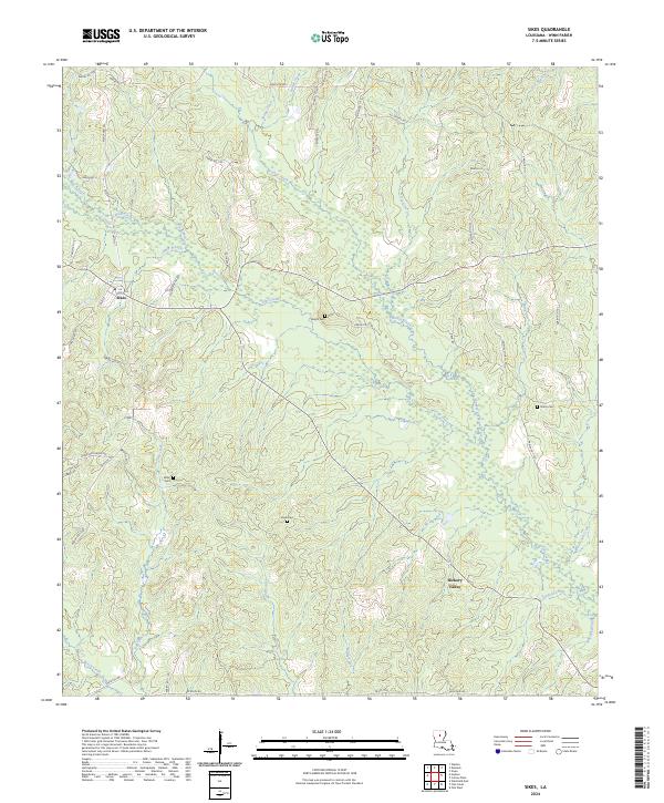
2024 Map of Sikes
USGS Topo · Published 2024About this map
Sikes and Hickory Valley anchor this Winn Parish landscape, where the settlement pattern follows a dense network of watercourses and rural parish roads. The terrain is defined by the convergence of numerous named streams, including Turkey Creek, Fish Creek, and Flat Creek, which carve through the piney woods of North Louisiana. This 2024 edition documents a region where local family history is deeply tied to the land, as evidenced by several smaller burial sites like Wright Cem, Starns Cem, Willis Cem, and Smith Cem located away from the primary town centers. The road network, including State Rte 499 and Sharon Ch Rd, provides the modern framework for navigating these historic townships and the riparian corridors of Wolf Creek and Caney Creek.
Find a feature on this map
62 named features on this map. Tap any name to fly to it.
Don’t see what you’re looking for? This feature index may not catch every label — zoom into the map to look around manually.
Map Details
Editions of this 2024 Sikes Map
This is the sole edition of this map. No revisions or reprints were ever made.
Other maps of this area

1949 · Jonesboro
USGS Topo · 1:62,500

1950 · Jonesboro
USGS Topo · 1:62,500

1950 · Winnfield
USGS Topo · 1:62,500

1951 · Winnfield
USGS Topo · 1:62,500

1953 · Alexandria
USGS Topo · 1:250,000

1954 · Sikes
USGS Topo · 1:62,500

1954 · Tullos
USGS Topo · 1:62,500

1955 · Shreveport
USGS Topo · 1:250,000

1955 · Alexandria
USGS Topo · 1:250,000

1956 · Shreveport
USGS Topo · 1:250,000