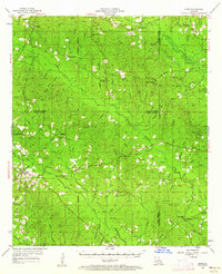
1954 Map of Sikes
USGS Topo · Published 1962About this map
Sikes and the surrounding piney woods of North Louisiana are documented here during the mid-1950s, showing a landscape defined by small rural congregations and timber-related infrastructure. The map records a high density of country churches, such as Sharon Ch, Hebron Ch, and Old Union Ch, which served as the primary social anchors for the scattered population. Notable landmarks of the era include the Sikes Lookout Tower and Hoods Mill Lookout Tower, indicating the critical importance of fire observation for the local forest economy.
Find a feature on this map
99 named features on this map. Tap any name to fly to it.
Don’t see what you’re looking for? This feature index may not catch every label — zoom into the map to look around manually.
Map Details
Editions of this 1954 Sikes Map
4 editions found
Other maps of this area

1940 · Monroe
USGS Topo · 1:62,500

1940 · Columbia
USGS Topo · 1:62,500

1949 · Jonesboro
USGS Topo · 1:62,500

1950 · Jonesboro
USGS Topo · 1:62,500

1950 · Winnfield
USGS Topo · 1:62,500

1951 · Winnfield
USGS Topo · 1:62,500

1953 · Chatham
USGS Topo · 1:62,500

1953 · Hodge
USGS Topo · 1:62,500

1953 · Alexandria
USGS Topo · 1:250,000

1954 · Sikes
USGS Topo · 1:62,500