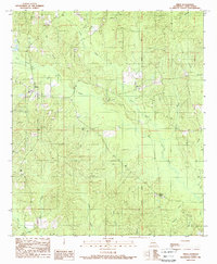
1989 Map of Sikes
USGS Topo · Published 1989About this map
Sikes serves as the primary settlement in this north-central Louisiana landscape, appearing as it did in the late 1980s. The geography is defined by a dense network of drainage systems, including the southward-flowing Turkey Creek, Flat Creek, and Fish Creek. To the east, Hickory Valley and Dry Hill offer distinct topographic variation in a region otherwise dominated by creek bottoms and piney woods.
Find a feature on this map
24 named features on this map. Tap any name to fly to it.
Don’t see what you’re looking for? This feature index may not catch every label — zoom into the map to look around manually.
Map Details
Editions of this 1989 Sikes Map
This is the sole edition of this map. No revisions or reprints were ever made.
Other maps of this area

1949 · Jonesboro
USGS Topo · 1:62,500

1950 · Jonesboro
USGS Topo · 1:62,500

1950 · Winnfield
USGS Topo · 1:62,500

1951 · Winnfield
USGS Topo · 1:62,500

1953 · Alexandria
USGS Topo · 1:250,000

1954 · Sikes
USGS Topo · 1:62,500

1954 · Tullos
USGS Topo · 1:62,500

1955 · Shreveport
USGS Topo · 1:250,000

1955 · Alexandria
USGS Topo · 1:250,000

1956 · Shreveport
USGS Topo · 1:250,000