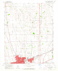
1963 Map of Sikeston North
USGS Topo · Published 1964About this map
Sikeston dominates the southern portion of this Missouri survey, revealing its mid-century layout along the Missouri Pacific and St Louis - San Francisco railroads. The town's expansion is evident through its residential grid, including Kathleen Ave and Oklahoma St, and municipal landmarks like the Sikeston Memorial Airport and Rodeo Grounds. North of the city, the land transitions into the agricultural expanse of Sikeston Ridge and the Sandy Woods.
Find a feature on this map
50 named features on this map. Tap any name to fly to it.
Don’t see what you’re looking for? This feature index may not catch every label — zoom into the map to look around manually.
Map Details
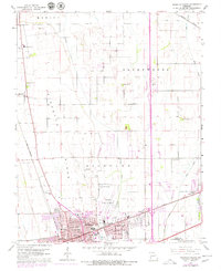
Editions of this 1963 Sikeston North Map
2 editions found
Other maps of this area

1931 · Sikeston
USGS Topo · 1:62,500

1934 · Thebes
USGS Topo · 1:62,500

1934 · Morley
USGS Topo · 1:62,500

1934 · Sikeston
USGS Topo · 1:62,500

1939 · Sikeston
USGS Topo · 1:62,500

1939 · Charleston
USGS Topo · 1:62,500

1939 · Morley
USGS Topo · 1:62,500

1939 · Thebes
USGS Topo · 1:62,500

1949 · Paducah
USGS Topo · 1:250,000

1950 · Paducah
USGS Topo · 1:250,000