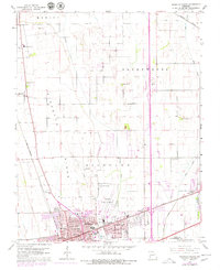
1963 Map of Sikeston North
USGS Topo · Published 1979About this map
The northern reaches of Sikeston anchor this 1963 study of the Missouri Bootheel, where the grid of the city meets the expansive agricultural lowlands of Richland and Long Prairie. The landscape is defined by the high ground of Sikeston Ridge, a natural elevated feature that historically dictated settlement patterns and transit routes away from the surrounding swampy bottoms. Regional infrastructure is prominently displayed, from the Sikeston Memorial Airport and the Country Club to the intersecting corridors of the St Louis - San Francisco and Missouri Pacific railroads.
Find a feature on this map
46 named features on this map. Tap any name to fly to it.
Don’t see what you’re looking for? This feature index may not catch every label — zoom into the map to look around manually.
Map Details
Editions of this 1963 Sikeston North Map
2 editions found
Other maps of this area

1931 · Sikeston
USGS Topo · 1:62,500

1934 · Thebes
USGS Topo · 1:62,500

1934 · Morley
USGS Topo · 1:62,500

1934 · Sikeston
USGS Topo · 1:62,500

1939 · Sikeston
USGS Topo · 1:62,500

1939 · Charleston
USGS Topo · 1:62,500

1939 · Morley
USGS Topo · 1:62,500

1939 · Thebes
USGS Topo · 1:62,500

1949 · Paducah
USGS Topo · 1:250,000

1950 · Paducah
USGS Topo · 1:250,000