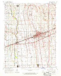
1963 Map of Sikeston
USGS Topo · Published 1968About this map
The Missouri Bootheel landscape around Sikeston in the mid-1960s is defined by its intricate drainage network and the convergence of major rail lines. As a regional hub, the city is flanked by a lattice of agricultural infrastructure, including the North Cut Ditch and the Castor River, which transformed these lowlands into productive farmland. The St Louis-San Francisco and Missouri Pacific railroads bisect the territory, anchoring small communities like Morehouse and Vanduser.
Find a feature on this map
58 named features on this map. Tap any name to fly to it.
Don’t see what you’re looking for? This feature index may not catch every label — zoom into the map to look around manually.
Map Details
Editions of this 1963 Sikeston Map
This is the sole edition of this map. No revisions or reprints were ever made.
Other maps of this area

1931 · Sikeston
USGS Topo · 1:62,500

1934 · Thebes
USGS Topo · 1:62,500

1934 · Morley
USGS Topo · 1:62,500

1934 · Bloomfield
USGS Topo · 1:62,500

1934 · Sikeston
USGS Topo · 1:62,500

1934 · Advance
USGS Topo · 1:62,500

1939 · Bloomfield
USGS Topo · 1:62,500

1939 · Sikeston
USGS Topo · 1:62,500

1939 · Charleston
USGS Topo · 1:62,500

1939 · New Madrid
USGS Topo · 1:62,500