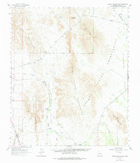
1963 Map of Sikort Chuapo Mts
USGS Topo · Published 1977About this map
The Papago Indian Reservation defines much of this desert landscape in the early 1960s, showing a network of remote settlements and vital water sources. Small outposts like Sikort Chuapo and Hoa Murk are linked by tracks across the Pozo Redondo Valley, while the unusual junction at Why sits near the western boundary. The reliance on seasonal water flow and groundwater is evident through the naming of Tenmile Wash and Coffeepot Well.
Find a feature on this map
25 named features on this map. Tap any name to fly to it.
Don’t see what you’re looking for? This feature index may not catch every label — zoom into the map to look around manually.
Map Details
Editions of this 1963 Sikort Chuapo Mts Map
2 editions found

Other maps of this area

1932 · Ajo
USGS Topo · 1:62,500

1934 · Ajo
USGS Topo · 1:62,500

1953 · Ajo
USGS Topo · 1:250,000

1957 · Ajo
USGS Topo · 1:250,000

1958 · Ajo
USGS Topo · 1:250,000

1958 · Kaka
USGS Topo · 1:62,500

1958 · Midway
USGS Topo · 1:62,500

1958 · Hat Mountain
USGS Topo · 1:62,500

1962 · Ajo
USGS Topo · 1:250,000

1963 · Ajo
USGS Topo · 1:250,000