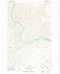
1971 Map of Silcott
USGS Topo · Published 1974About this map
The Snake River defines the heart of this 1971 survey, carving a deep path through the canyonlands where Whitman, Garfield, and Asotin counties meet. The small settlement of Silcott sits on the southern bank near the mouth of Alpowa Creek, a site of significant local history marked by the Indian Timothy Bridge and a nearby Cem. These features point to the area's role as a traditional crossing point and early habitation site before the river's character was altered by modern infrastructure.
Find a feature on this map
24 named features on this map. Tap any name to fly to it.
Don’t see what you’re looking for? This feature index may not catch every label — zoom into the map to look around manually.
Map Details
Editions of this 1971 Silcott Map
This is the sole edition of this map. No revisions or reprints were ever made.
Other maps of this area

1910 · Pullman
USGS Topo · 1:125,000

1943 · Peola
USGS Topo · 1:62,500

1945 · Clarkston
USGS Topo · 1:62,500

1946 · Peola
USGS Topo · 1:62,500

1948 · Clarkston
USGS Topo · 1:62,500

1955 · Pullman
USGS Topo · 1:250,000

1958 · Pullman
USGS Topo · 1:250,000

1964 · Colton
USGS Topo · 1:24,000

1964 · Bishop
USGS Topo · 1:24,000
1964 · Uniontown
USGS Topo · 1:24,000