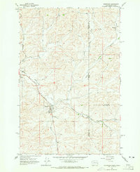
1964 Map of Uniontown
USGS Topo · Published 1965About this map
Uniontown and Colton anchor this mid-1960s survey of the Palouse region, where the Northern Pacific railroad tracks wind through a landscape defined by rolling agricultural plateaus. The topography is marked by distinctive level areas such as Union Flat and Leon Flat, which provided the foundational terrain for local farming and early development. The map details the community infrastructure of the era, including the St Boniface Sch and nearby Cem in Uniontown, while the outlying landscape is dotted with rural landmarks like the Thorn Creek Ranch. Several watercourses, including Thorn Creek, Little Thorn Creek, and Cow Creek, carve through the hills. This document effectively captures the rural character of the Washington-Idaho borderlands before significant modern expansion, highlighting the economic reliance on the rail line and local resources like the various Gravel Pits scattered across the quadrangle.
Find a feature on this map
20 named features on this map. Tap any name to fly to it.
Don’t see what you’re looking for? This feature index may not catch every label — zoom into the map to look around manually.
Map Details
Editions of this 1964 Uniontown Map
This is the sole edition of this map. No revisions or reprints were ever made.
Other maps of this area

1910 · Pullman
USGS Topo · 1:125,000

1945 · Clarkston
USGS Topo · 1:62,500

1948 · Clarkston
USGS Topo · 1:62,500

1955 · Pullman
USGS Topo · 1:250,000

1958 · Pullman
USGS Topo · 1:250,000

1958 · Lewiston Orchards North
USGS Topo · 1:24,000

1958 · Lewiston Orchards
USGS Topo · 1:62,500

1960 · Moscow East
USGS Topo · 1:24,000

1961 · Moscow
USGS Topo · 1:62,500

1964 · Moscow West
USGS Topo · 1:24,000