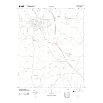
2010 Map of Siler City
USGS Topo · Published 2010About this map
Siler City serves as the primary hub of this Chatham County landscape, where the confluence of modern highway infrastructure meets a network of historic rural routes. The town is flanked by geographic markers such as Blood Run and Loves Creek, with Oakwood Cemetery situated near its northwestern edge. This 2010 digital survey captures the transition from the concentrated residential and commercial blocks of the city to the surrounding agricultural and timbered lands.
Find a feature on this map
66 named features on this map. Tap any name to fly to it.
Don’t see what you’re looking for? This feature index may not catch every label — zoom into the map to look around manually.
Map Details
Editions of this 2010 Siler City Map
This is the sole edition of this map. No revisions or reprints were ever made.
Other maps of this area

1953 · Raleigh
USGS Topo · 1:250,000

1954 · Raleigh
USGS Topo · 1:250,000

1968 · Coleridge
USGS Topo · 1:24,000

1968 · Bennett
USGS Topo · 1:24,000

1969 · Siler City
USGS Topo · 1:24,000

1970 · Goldston
USGS Topo · 1:24,000

1970 · Bear Creek
USGS Topo · 1:24,000

1970 · Siler City NE
USGS Topo · 1:24,000

1974 · Silk Hope
USGS Topo · 1:24,000

1974 · Crutchfield Crossroads
USGS Topo · 1:24,000