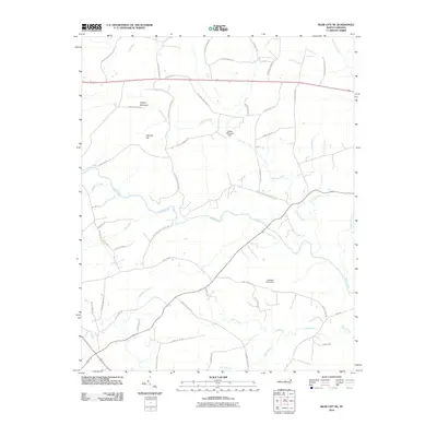
2010 Map of Siler City NE
USGS Topo · Published 2010About this map
Hickory Mountain and Carolina Hill rise above the drainage basins of central North Carolina, defining a landscape etched by the Rocky River and its numerous tributaries. This survey shows the region's agricultural and rural structure at the start of the 21st century, where many roads carry the names of long-established local families. Significant water management is evident at Hadley Millpond Dam on Landrum Creek and Cameron Pond Dam further south, illustrating how the natural flow of Bear Creek and Harts Creek has been harnessed over time. The map detail reflects a transition from traditional land use toward more modern infrastructure, such as the County Landfill Rd and the path of Old Hwy 64. These labels provide a clear picture of the community's geographic heritage, from the winding path of Tick Creek to the various branches that sustain the local watershed.
Find a feature on this map
51 named features on this map. Tap any name to fly to it.
Don’t see what you’re looking for? This feature index may not catch every label — zoom into the map to look around manually.
Map Details
Editions of this 2010 Siler City NE Map
This is the sole edition of this map. No revisions or reprints were ever made.
Other maps of this area

1953 · Raleigh
USGS Topo · 1:250,000

1954 · Raleigh
USGS Topo · 1:250,000

1968 · Bynum
USGS Topo · 1:24,000

1969 · Siler City
USGS Topo · 1:24,000

1970 · Goldston
USGS Topo · 1:24,000

1970 · Pittsboro
USGS Topo · 1:24,000

1970 · Colon
USGS Topo · 1:24,000

1970 · Bear Creek
USGS Topo · 1:24,000

1970 · Siler City NE
USGS Topo · 1:24,000

1974 · Silk Hope
USGS Topo · 1:24,000