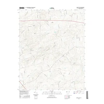
2016 Map of Siler City NE
USGS Topo · Published 2016About this map
The Rocky River carves a winding path through this portion of Chatham County, defining a landscape shaped by narrow creek valleys and prominent rises like Hickory Mtn and Carolina Hill. This area is characterized by a dense network of family-named roads and rural infrastructure, including the private Dead Dog Airport situated north of the main highway. The presence of Hadleys Mill Pond and Cameron Pond along the tributaries of the Rocky River suggests a long history of water management and local milling, while numerous small watercourses such as Landrum Cr and Meadow Cr dissect the terrain. Genealogists will find interest in the naming conventions of the local thoroughfares, which frequently reflect established family names like Zeb Ferguson Rd, Elmer Keck Rd, and Wilbur Straughn Rd, grounding the map in the community's local heritage.
Find a feature on this map
83 named features on this map. Tap any name to fly to it.
Don’t see what you’re looking for? This feature index may not catch every label — zoom into the map to look around manually.
Map Details
Editions of this 2016 Siler City NE Map
This is the sole edition of this map. No revisions or reprints were ever made.
Other maps of this area

1953 · Raleigh
USGS Topo · 1:250,000

1954 · Raleigh
USGS Topo · 1:250,000

1968 · Bynum
USGS Topo · 1:24,000

1969 · Siler City
USGS Topo · 1:24,000

1970 · Goldston
USGS Topo · 1:24,000

1970 · Pittsboro
USGS Topo · 1:24,000

1970 · Colon
USGS Topo · 1:24,000

1970 · Bear Creek
USGS Topo · 1:24,000

1970 · Siler City NE
USGS Topo · 1:24,000

1974 · Silk Hope
USGS Topo · 1:24,000