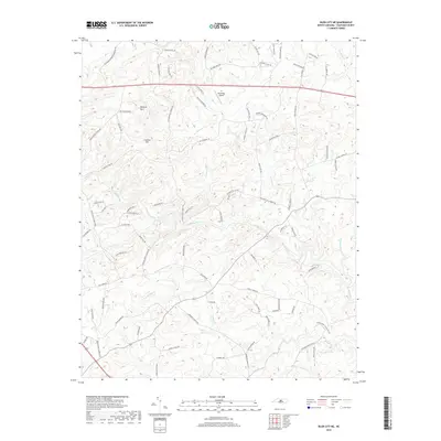
2019 Map of Siler City NE
USGS Topo · Published 2019About this map
Rocky River winds through the heart of this Chatham County landscape, defining the topography of an area characterized by family farms and rural homesteads. The terrain is marked by significant elevations such as Hickory Mtn and Carolina Hill, which overlook a network of tributary streams including Little Bear Cr, Landrum Cr, and Tick Cr. This 2019 survey documents a contemporary view of North Carolina’s Piedmont, where established agricultural roots meet modern small-scale aviation at the curiously named Dead Dog Airport. The map traces numerous rural routes like Mt Vernon Hickory Mountain Rd and Rives Chapel Church Rd, illustrating the persistent connectivity between historic church sites and the surrounding countryside. A complex drainage system including Harlands Cr and Georges Cr further reveals the natural hydrology that has shaped local land use for generations.
Find a feature on this map
85 named features on this map. Tap any name to fly to it.
Don’t see what you’re looking for? This feature index may not catch every label — zoom into the map to look around manually.
Map Details
Editions of this 2019 Siler City NE Map
This is the sole edition of this map. No revisions or reprints were ever made.
Other maps of this area

1953 · Raleigh
USGS Topo · 1:250,000

1954 · Raleigh
USGS Topo · 1:250,000

1968 · Bynum
USGS Topo · 1:24,000

1969 · Siler City
USGS Topo · 1:24,000

1970 · Goldston
USGS Topo · 1:24,000

1970 · Pittsboro
USGS Topo · 1:24,000

1970 · Colon
USGS Topo · 1:24,000

1970 · Bear Creek
USGS Topo · 1:24,000

1970 · Siler City NE
USGS Topo · 1:24,000

1974 · Silk Hope
USGS Topo · 1:24,000