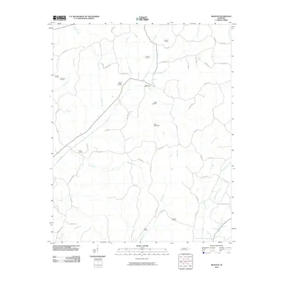
2010 Map of Silerton
USGS Topo · Published 2010About this map
Silerton serves as the primary hub of this rural West Tennessee landscape, where the town and nearby Todd Siding are surrounded by a dense network of country roads and creek drainages. The area is heavily defined by its small community burial grounds, including the Antioch Cemetery, Old Center Cemetery, and Palestine Cemetery, which offer valuable locations for genealogical research into the local families.
Find a feature on this map
58 named features on this map. Tap any name to fly to it.
Don’t see what you’re looking for? This feature index may not catch every label — zoom into the map to look around manually.
Map Details
Editions of this 2010 Silerton Map
This is the sole edition of this map. No revisions or reprints were ever made.
Other maps of this area

1950 · Hebron
USGS Topo · 1:24,000

1950 · Hornsby
USGS Topo · 1:24,000

1951 · Hebron
USGS Topo · 1:24,000

1951 · Hornsby
USGS Topo · 1:24,000

1951 · Rose Creek
USGS Topo · 1:24,000

1956 · Blytheville
USGS Topo · 1:250,000

1959 · Blytheville
USGS Topo · 1:250,000

1961 · Medon
USGS Topo · 1:24,000
1961 · Silerton
USGS Topo · 1:24,000
1961 · Bolivar East
USGS Topo · 1:24,000