2022 Map of Silerton
USGS Topo · Published 2022About this map
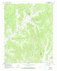
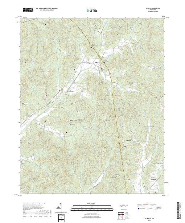
Chickasaw State Park borders the western edge of this West Tennessee landscape, where the headwaters of Piney Creek and Grays Cr carve through the dividing ridges between Hardeman and Chester counties. The settlement of Silerton sits as a central hub for the surrounding rural communities of Piney Grove, Pine Top, and Palestine. This 2022 survey reveals a high density of ancestral landmarks, particularly small family and community burial grounds like Savage Cem, Old Concord Cem, and Wesley Cem. The terrain is defined by a network of creeks, including Greasy Cr and Little Piney Cr, which drain the area surrounding Ross Mtn. In the southeast corner, the community of Woodville marks the junction near Woodville Cr, illustrating the long-standing settlement patterns of this agricultural and timber-rich region.
Find a feature on this map
88 named features on this map. Tap any name to fly to it.
Don’t see what you’re looking for? This feature index may not catch every label — zoom into the map to look around manually.
Map Details
Editions of this 2022 Silerton Map
This is the sole edition of this map. No revisions or reprints were ever made.
Historical Maps of Palestine Through Time
6 maps found