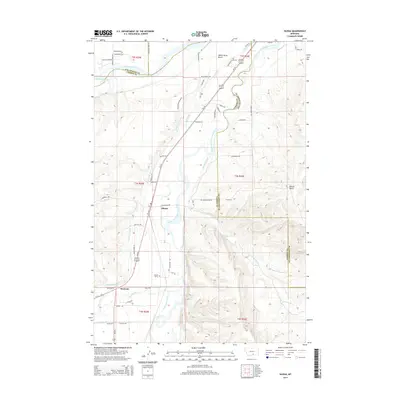
2014 Map of Silesia
USGS Topo · Published 2014About this map
The Clarks Fork Yellowstone River carves a central path through this Montana landscape, where the communities of Silesia and Rockvale serve as focal points for a region defined by complex irrigation and river geography. Extensive water management systems including the White Horse Canal, Mason Canal, and Smith Ditch reveal the agricultural engineering required to sustain the valley. The terrain transitions from the river bottom to prominent landforms like White Horse Bench and the isolated Round Butte to the east. Of particular interest for genealogical research is the isolated Howell Grave located south of Silesia. The map also documents historical transportation routes, such as Bundy Ferry Rd, which once connected these riverfront settlements before modern infrastructure like Us-212 and Us-310 became the primary arteries.
Find a feature on this map
65 named features on this map. Tap any name to fly to it.
Don’t see what you’re looking for? This feature index may not catch every label — zoom into the map to look around manually.
Map Details
Editions of this 2014 Silesia Map
This is the sole edition of this map. No revisions or reprints were ever made.
Other maps of this area

1954 · Billings
USGS Topo · 1:250,000

1956 · Silesia
USGS Topo · 1:24,000

1956 · Fromberg
USGS Topo · 1:24,000

1956 · Laurel
USGS Topo · 1:24,000

1956 · Park City
USGS Topo · 1:24,000

1956 · Edgar
USGS Topo · 1:24,000
1956 · Montaqua
USGS Topo · 1:24,000

1956 · Mossmain
USGS Topo · 1:24,000

1957 · Billings
USGS Topo · 1:250,000

1958 · Billings
USGS Topo · 1:250,000