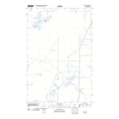
2010 Map of Silica
USGS Topo · Published 2010About this map
West Swan River meanders through this landscape of the Iron Range region, where small settlements and a complex system of water management define the geography. The small community of Silica sits at a crossroads in the southeast, while Bengal and its namesake Bengal Hill anchor the central portion of the map. This area is characterized by numerous small lakes and managed reservoirs, including Reservoir Number Six and Reservoir Two, which are supported by features like the Reservoir Number Six Dam.
Find a feature on this map
40 named features on this map. Tap any name to fly to it.
Don’t see what you’re looking for? This feature index may not catch every label — zoom into the map to look around manually.
Map Details
Editions of this 2010 Silica Map
This is the sole edition of this map. No revisions or reprints were ever made.
Other maps of this area

1951 · Hibbing
USGS Topo · 1:24,000

1952 · Keewatin
USGS Topo · 1:24,000

1952 · Riley
USGS Topo · 1:24,000

1952 · Nashwauk
USGS Topo · 1:24,000

1952 · Silica
USGS Topo · 1:24,000

1952 · Pengilly
USGS Topo · 1:24,000

1954 · Hibbing
USGS Topo · 1:250,000

1957 · Hibbing
USGS Topo · 1:250,000

1957 · Hibbing
USGS Topo · 1:24,000

1958 · Hibbing
USGS Topo · 1:250,000