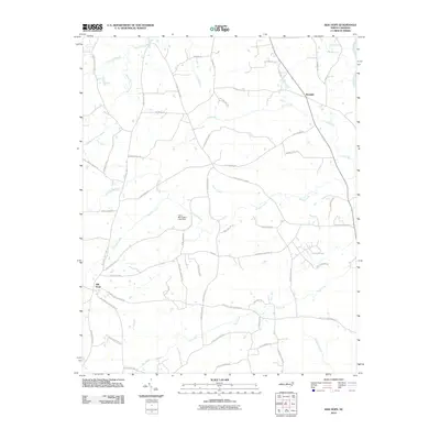
2010 Map of Silk Hope
USGS Topo · Published 2010About this map
The unincorporated community of Silk Hope serves as a focal point for this rural Chatham County landscape, characterized by a dense network of family-named roads and winding watercourses. Significant hydrologic features including South Fork Cane Creek and Terrells Creek define the local drainage, while the eastern edge is marked by the course of the Haw River. The presence of Camp Maranatha Lake Dam indicates more contemporary land use alongside older crossroads such as Mandale.
Find a feature on this map
62 named features on this map. Tap any name to fly to it.
Don’t see what you’re looking for? This feature index may not catch every label — zoom into the map to look around manually.
Map Details
Editions of this 2010 Silk Hope Map
This is the sole edition of this map. No revisions or reprints were ever made.
Other maps of this area

1953 · Raleigh
USGS Topo · 1:250,000

1954 · Raleigh
USGS Topo · 1:250,000

1968 · White Cross
USGS Topo · 1:24,000

1968 · Bynum
USGS Topo · 1:24,000

1969 · Siler City
USGS Topo · 1:24,000

1970 · Pittsboro
USGS Topo · 1:24,000

1970 · Siler City NE
USGS Topo · 1:24,000

1974 · Silk Hope
USGS Topo · 1:24,000

1974 · Crutchfield Crossroads
USGS Topo · 1:24,000
1977 · Saxapahaw
USGS Topo · 1:24,000