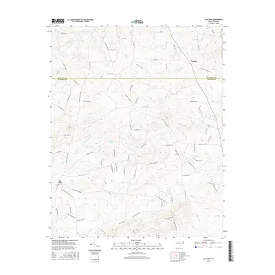
2016 Map of Silk Hope
USGS Topo · Published 2016About this map
Silk Hope and Mandale anchor this rural landscape in the Piedmont region of North Carolina, where the boundary between Alamance and Chatham counties follows the path of Lick Cr. This era shows a community defined by its sprawling road network and numerous family-named landmarks such as Braxton Ln, Woody Store Rd, and Archie Johnson Rd. The terrain is deeply carved by a dense hydrological system, with the Haw River cutting across the northeastern corner and several significant tributaries, including Terrells Cr, Harlands Cr, and S Fork Cane Cr, draining the surrounding hills. A notable feature of the local topography is Camp Maranatha Lake, which serves as a central point for the community south of Lick Cr. The survey illustrates the transition from traditional farmstead access to modern thoroughfares while maintaining the original rural character of the settlements.
Find a feature on this map
84 named features on this map. Tap any name to fly to it.
Don’t see what you’re looking for? This feature index may not catch every label — zoom into the map to look around manually.
Map Details
Editions of this 2016 Silk Hope Map
This is the sole edition of this map. No revisions or reprints were ever made.
Other maps of this area

1953 · Raleigh
USGS Topo · 1:250,000

1954 · Raleigh
USGS Topo · 1:250,000

1968 · White Cross
USGS Topo · 1:24,000

1968 · Bynum
USGS Topo · 1:24,000

1969 · Siler City
USGS Topo · 1:24,000

1970 · Pittsboro
USGS Topo · 1:24,000

1970 · Siler City NE
USGS Topo · 1:24,000

1974 · Silk Hope
USGS Topo · 1:24,000

1974 · Crutchfield Crossroads
USGS Topo · 1:24,000
1977 · Saxapahaw
USGS Topo · 1:24,000