
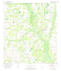
1952 Map of Sills
USGS Topo · Published 1953About this map
Marshall Creek and the Chipola River define the watery landscape of this Florida-Alabama border region during the early 1950s. The settlement of Sills serves as a local hub, surrounded by a dense network of country churches including Ephesus Ch, St Phillips Ch, and Holyneck Ch. This era shows the rural infrastructure of Jackson County transitioning, evidenced by the presence of Auxiliary Field No 1 (Abandoned) and educational sites like the Caniehead Sch and Fork of the Creeks Sch.
Find a feature on this map
32 named features on this map. Tap any name to fly to it.
Don’t see what you’re looking for? This feature index may not catch every label — zoom into the map to look around manually.
Map Details
Editions of this 1952 Sills Map
2 editions found
Other maps of this area

1952 · Cottondale East
USGS Topo · 1:24,000

1952 · Malone
USGS Topo · 1:24,000

1952 · Campbellton
USGS Topo · 1:24,000

1952 · Cottondale West
USGS Topo · 1:24,000

1952 · Marianna
USGS Topo · 1:24,000

1953 · Dothan
USGS Topo · 1:250,000

1954 · Dothan
USGS Topo · 1:250,000

1954 · Tallahassee
USGS Topo · 1:250,000

1955 · Dothan
USGS Topo · 1:250,000

1959 · Tallahassee
USGS Topo · 1:250,000