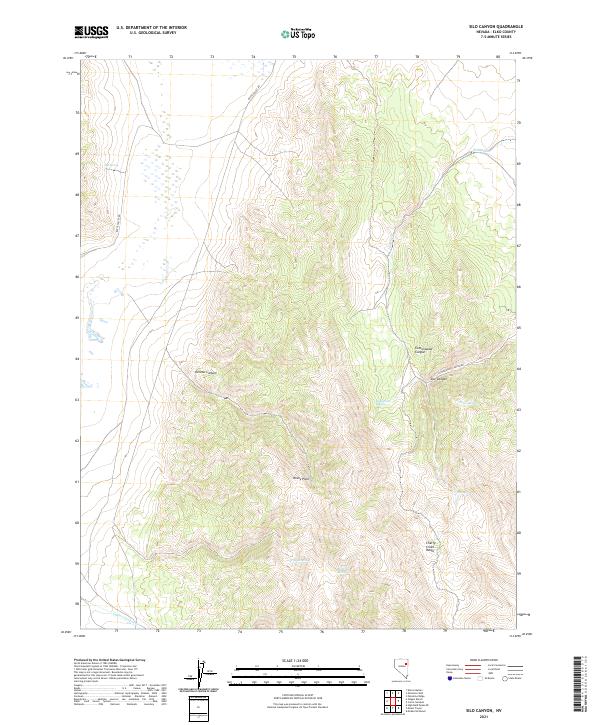
2021 Map of Silo Canyon
USGS Topo · Published 2021About this map
The Cherry Creek Range dominates this corner of Elko County, Nevada, where the high-altitude landscape is defined by its seasonal water sources and steep drainages. Remote and sparsely developed, the area centers on the namesake Silo Canyon and the prominent Rocky Point. Connectivity in this basin-and-range terrain is provided by rugged paths like Butte Valley Rd and Cottonwood Canyon Rd, which follow the natural contours of the land. The presence of numerous named water sources, such as Hill Spring, Mustang Spring, and Augustine Spring, suggests the long-standing importance of this territory for livestock grazing and high-desert survival. From the depths of Denton Canyon to the reaches of Phalen Cr, the map records a workspace of ranching and natural landmarks.
Find a feature on this map
21 named features on this map. Tap any name to fly to it.
Don’t see what you’re looking for? This feature index may not catch every label — zoom into the map to look around manually.
Map Details
Editions of this 2021 Silo Canyon Map
This is the sole edition of this map. No revisions or reprints were ever made.
Other maps of this area

1955 · Elko
USGS Topo · 1:250,000

1958 · Elko
USGS Topo · 1:250,000

1962 · Elko
USGS Topo · 1:250,000

1965 · Elko
USGS Topo · 1:250,000

1984 · Currie Gardens
USGS Topo · 1:24,000
1984 · Mt. Taylor
USGS Topo · 1:24,000

1984 · Silo Canyon
USGS Topo · 1:24,000
1984 · McDermid Ranch
USGS Topo · 1:24,000

1984 · Delcer Buttes
USGS Topo · 1:24,000
1984 · Palomino Well
USGS Topo · 1:24,000