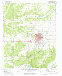
1972 Map of Siloam Springs
USGS Topo · Published 1974About this map
Siloam Springs serves as the focal point of this early 1970s survey, straddling the state line where Oklahoma and Arkansas meet. The town's layout is intricately detailed, showing the campus of John Brown University and several community landmarks like the Oak Hill Cemetery and the local Hospital. The landscape is defined by the winding course of Flint Creek and its many tributaries, such as Sager Creek, which flow through the undulating terrain near Moseley Prairie. To the south, the Illinois River and Lake Frances create a distinct riparian border.
Find a feature on this map
48 named features on this map. Tap any name to fly to it.
Don’t see what you’re looking for? This feature index may not catch every label — zoom into the map to look around manually.
Map Details
Editions of this 1972 Siloam Springs Map
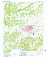
2 editions found
Other maps of this area

1899 · Fayetteville
USGS Topo · 1:125,000

1899 · Siloam Springs
USGS Topo · 1:125,000

1901 · Fayetteville
USGS Topo · 1:125,000

1903 · Siloam Springs
USGS Topo · 1:125,000

1904 · Siloam Springs
USGS Topo · 1:125,000

1904 · Fayetteville
USGS Topo · 1:125,000

1954 · Tulsa
USGS Topo · 1:250,000

1958 · Tulsa
USGS Topo · 1:250,000

1963 · Tulsa
USGS Topo · 1:250,000

1970 · Gallatin
USGS Topo · 1:24,000