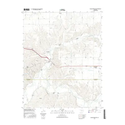
2016 Map of Siloam Springs NW
USGS Topo · Published 2016About this map
Illinois River crossings and Ozark foothills define the landscape of this 2016 survey, where the borders of Delaware and Adair counties meet. The settlement of West Siloam Springs serves as a primary hub in the east, while the smaller communities of Colcord and Chewey anchor the northern and southern reaches. The terrain is marked by distinctive topographic features such as Moseley Prairie and several named hollows, including Hazelnut Hollow and Tahlequah Hollow.
Find a feature on this map
104 named features on this map. Tap any name to fly to it.
Don’t see what you’re looking for? This feature index may not catch every label — zoom into the map to look around manually.
Map Details
Editions of this 2016 Siloam Springs NW Map
This is the sole edition of this map. No revisions or reprints were ever made.
Other maps of this area

1899 · Siloam Springs
USGS Topo · 1:125,000

1903 · Siloam Springs
USGS Topo · 1:125,000

1904 · Siloam Springs
USGS Topo · 1:125,000

1954 · Tulsa
USGS Topo · 1:250,000

1958 · Tulsa
USGS Topo · 1:250,000

1963 · Tulsa
USGS Topo · 1:250,000

1971 · Jay SE
USGS Topo · 1:24,000
1971 · Cherokee City
USGS Topo · 1:24,000
1971 · Colcord
USGS Topo · 1:24,000
1972 · Chance
USGS Topo · 1:24,000