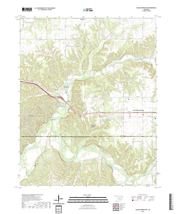
2022 Map of Siloam Springs NW
USGS Topo · Published 2022About this map
West Siloam Springs and the small communities of Colcord, Beckwith, and Flint define the landscape of eastern Delaware County in this modern survey. The terrain transitions from the open expanse of Moseley Prairie into a network of steep-sided drainages, including Fivemile Hollow, Hazelnut Hollow, and Tahlequah Hollow. The southern portion of the map is dominated by the winding course of the Illinois River, which is joined by Dripping Springs Br and flows past Kill Hollow. Genealogy researchers will find several well-defined burial sites, including Crittenden Cem, Allen Cem, and Johnson Cem. The map illustrates a contemporary pattern of rural development where state highways and county roads, such as New Life Ranch RD, connect dispersed settlements like Dripping Springs to larger hubs. Notable water features include the horseshoe bend at Fidlers Bend and the shoreline of Clear Cr Lake.
Find a feature on this map
112 named features on this map. Tap any name to fly to it.
Don’t see what you’re looking for? This feature index may not catch every label — zoom into the map to look around manually.
Map Details
Editions of this 2022 Siloam Springs NW Map
This is the sole edition of this map. No revisions or reprints were ever made.
Other maps of this area

1899 · Siloam Springs
USGS Topo · 1:125,000

1903 · Siloam Springs
USGS Topo · 1:125,000

1904 · Siloam Springs
USGS Topo · 1:125,000

1954 · Tulsa
USGS Topo · 1:250,000

1958 · Tulsa
USGS Topo · 1:250,000

1963 · Tulsa
USGS Topo · 1:250,000

1971 · Jay SE
USGS Topo · 1:24,000
1971 · Cherokee City
USGS Topo · 1:24,000
1971 · Colcord
USGS Topo · 1:24,000
1972 · Chance
USGS Topo · 1:24,000