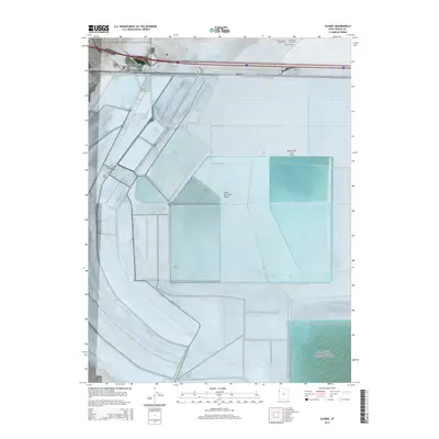
2014 Map of Silsbee
USGS Topo · Published 2014About this map
The Great Salt Lake Desert dominates this landscape, providing a stark white expanse of salt crust that has long defined the region's character and human activity. Near the edge of the desert, the Bonneville Salt Flats serve as a global destination for speed, featuring specialized infrastructure like the International Racetrack, the Bonneville Racetrack, and a dedicated Hot Rod Track. These features indicate the specialized land use of the flats, where the perfectly level terrain is utilized for land-speed record attempts. Linear development is concentrated along the northern edge of the map, where settlements like Wendover, Blair, and Silsbee are clustered. These towns sit along a vital transportation corridor, with Frontage RD and Interstate 80 facilitating movement through this otherwise desolate environment. The grid of township and range lines, such as t1s r19w and t1s r18w, provides a geometric structure over a landscape defined more by its geology than by dense habitation.
Find a feature on this map
13 named features on this map. Tap any name to fly to it.
Don’t see what you’re looking for? This feature index may not catch every label — zoom into the map to look around manually.
Map Details
Editions of this 2014 Silsbee Map
This is the sole edition of this map. No revisions or reprints were ever made.
Other maps of this area

1953 · Tooele
USGS Topo · 1:250,000

1955 · Tooele
USGS Topo · 1:250,000

1955 · Elko
USGS Topo · 1:250,000

1958 · Elko
USGS Topo · 1:250,000

1962 · Elko
USGS Topo · 1:250,000

1965 · Elko
USGS Topo · 1:250,000

1971 · Leppy Peak
USGS Topo · 1:24,000

1971 · Tetzlaff Peak
USGS Topo · 1:24,000

1971 · Bonneville Racetrack
USGS Topo · 1:24,000
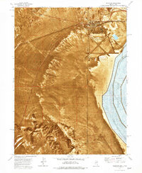
1972 · Wendover
USGS Topo · 1:24,000