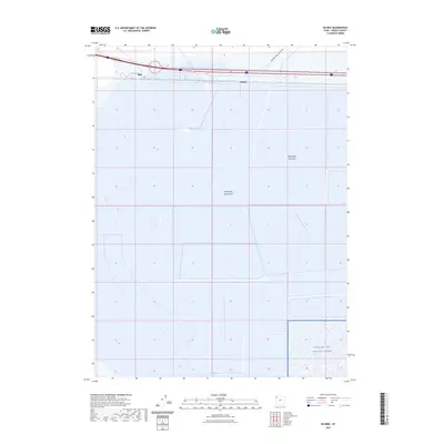
2023 Map of Silsbee
USGS Topo · Published 2023About this map
Bonneville Salt Flats and the surrounding Great Salt Lake Desert dominate this 2023 survey of Tooele County. The terrain is characterized by its expansive salt crusts and highly flat topography, which has historically facilitated high-speed motorized trials. The International Racetrack is visible in the northern portion of the quadrangle, situated near the small settlements of Blair and Silsbee. South of the salt crusts, the map identifies a portion of the Utah Test and Training Range, a military installation that utilizes the vast, unpopulated stretches of the desert. The landscape is a stark representation of the Great Basin’s geological history, where the evaporation of ancient Lake Bonneville left behind these distinctive mineral deposits.
Find a feature on this map
6 named features on this map. Tap any name to fly to it.
Don’t see what you’re looking for? This feature index may not catch every label — zoom into the map to look around manually.
Map Details
Editions of this 2023 Silsbee Map
This is the sole edition of this map. No revisions or reprints were ever made.
Other maps of this area

1953 · Tooele
USGS Topo · 1:250,000

1955 · Tooele
USGS Topo · 1:250,000

1955 · Elko
USGS Topo · 1:250,000

1958 · Elko
USGS Topo · 1:250,000

1962 · Elko
USGS Topo · 1:250,000

1965 · Elko
USGS Topo · 1:250,000

1971 · Leppy Peak
USGS Topo · 1:24,000

1971 · Tetzlaff Peak
USGS Topo · 1:24,000

1971 · Bonneville Racetrack
USGS Topo · 1:24,000
1972 · Wendover
USGS Topo · 1:24,000