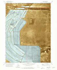
1973 Map of Silsbee
USGS Topo · Published 1977About this map
The Bonneville Salt Flats dominate this high-desert landscape in Tooele County, illustrating the scale of industrial mineral extraction in the early 1970s. Massive Evaporator Ponds and a network of infrastructure including a Pumping Station, Siphon, and several Brine Wells demonstrate how the brine was managed for salt production. Parallel to the Western Pacific railroad and Interstate 80, the small settlements of Silsbee and Blair sit near the rail line, while the Bonneville Racetrack marks the northern extent of the flats. The terrain is characterized by stretches of Alkali or Mud and shifting Sand Dunes, with human activity represented by the Wendover Air Force Range to the south and Danger Cave State Park on the western edge. This orthophotomap combines traditional topography with aerial photography to show the precise geometric patterns of the salt works against the natural desert floor.
Find a feature on this map
18 named features on this map. Tap any name to fly to it.
Don’t see what you’re looking for? This feature index may not catch every label — zoom into the map to look around manually.
Map Details
Editions of this 1973 Silsbee Map
This is the sole edition of this map. No revisions or reprints were ever made.
Other maps of this area

1953 · Tooele
USGS Topo · 1:250,000

1955 · Tooele
USGS Topo · 1:250,000

1955 · Elko
USGS Topo · 1:250,000

1958 · Elko
USGS Topo · 1:250,000

1962 · Elko
USGS Topo · 1:250,000

1965 · Elko
USGS Topo · 1:250,000

1971 · Leppy Peak
USGS Topo · 1:24,000

1971 · Tetzlaff Peak
USGS Topo · 1:24,000

1971 · Bonneville Racetrack
USGS Topo · 1:24,000
1972 · Wendover
USGS Topo · 1:24,000