
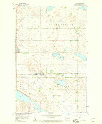
2011 Map of Silva
USGS Topo · Published 2011About this map
Silva serves as the quiet center of this Pierce County landscape, appearing as a small grid of streets surrounded by the glacial wetlands and prairie characteristic of the region. The settlement is anchored by Main St and 2nd Ave, with the Trinity Cemetery situated to the southeast, providing a vital point of reference for genealogists tracing local families. The terrain is dominated by numerous unnamed seasonal wetlands and depressions, illustrating the complex hydrology of the prairie pothole region. A rigid network of section-line roads, such as 57th St and 50th St Ne, organizes the agricultural territory, reflecting the enduring legacy of the Public Land Survey System in North Dakota.
Find a feature on this map
24 named features on this map. Tap any name to fly to it.
Don’t see what you’re looking for? This feature index may not catch every label — zoom into the map to look around manually.
Map Details
Editions of this 2011 Silva Map
This is the sole edition of this map. No revisions or reprints were ever made.
Other maps of this area

1953 · Devils Lake
USGS Topo · 1:250,000

1954 · Tunbridge
USGS Topo · 1:24,000

1954 · Minot
USGS Topo · 1:250,000

1955 · Rugby
USGS Topo · 1:24,000

1956 · Devils Lake
USGS Topo · 1:250,000

1958 · Minot
USGS Topo · 1:250,000

1958 · Balta SE
USGS Topo · 1:24,000

1958 · Fillmore
USGS Topo · 1:24,000

1958 · Balta
USGS Topo · 1:24,000
1958 · Silva
USGS Topo · 1:24,000