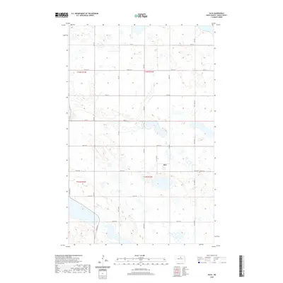
2020 Map of Silva
USGS Topo · Published 2020About this map
Silva serves as the primary focal point of this Pierce County landscape, situated within a vast network of section-line roads that define the rural character of North Dakota's prairie. The map reveals a high concentration of small, unnamed potholes and seasonal wetlands scattered across the terrain, illustrating the typical topography of the Prairie Pothole Region. To the southeast of the main settlement, Trinity Cem lies along 52nd St NE, providing a key landmark for genealogical researchers and those studying the early religious and community centers of the township. The grid of local thoroughfares, including 32nd Ave and 57th St, connects the various sections of T155N and T154N, tracing the organized land division used by early homesteaders and farmers in this agricultural heartland.
Find a feature on this map
26 named features on this map. Tap any name to fly to it.
Don’t see what you’re looking for? This feature index may not catch every label — zoom into the map to look around manually.
Map Details
Editions of this 2020 Silva Map
This is the sole edition of this map. No revisions or reprints were ever made.
Other maps of this area

1953 · Devils Lake
USGS Topo · 1:250,000

1954 · Tunbridge
USGS Topo · 1:24,000

1954 · Minot
USGS Topo · 1:250,000

1955 · Rugby
USGS Topo · 1:24,000

1956 · Devils Lake
USGS Topo · 1:250,000

1958 · Minot
USGS Topo · 1:250,000

1958 · Balta SE
USGS Topo · 1:24,000

1958 · Fillmore
USGS Topo · 1:24,000

1958 · Balta
USGS Topo · 1:24,000
1958 · Silva
USGS Topo · 1:24,000