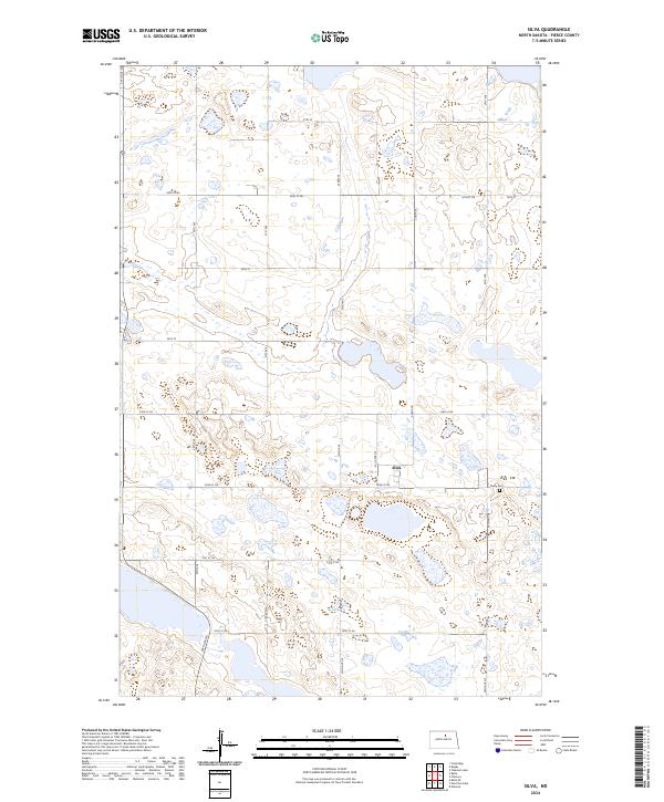
2024 Map of Silva
USGS Topo · Published 2024About this map
Silva serves as the central point of this North Dakota landscape, a small community defined by its proximity to the prairie potholes that characterize the region. The map reveals a high density of water bodies and wetlands, many of which are protected within the distributed sections of the Pierce County Waterfowl Production Area. This conservation network spans multiple townships, including t155n r72w and t154n r72w, illustrating a modern landscape where agricultural grid lines intersect with protected habitat for migratory birds. Just south of the town center, Trinity Cem stands as a local landmark for genealogical research, situated near the intersection of 34th Ave and 52nd St NE. The local road system, including routes like 30th Ave NE and 57th St, maintains the traditional section-line pattern typical of the Great Plains.
Find a feature on this map
27 named features on this map. Tap any name to fly to it.
Don’t see what you’re looking for? This feature index may not catch every label — zoom into the map to look around manually.
Map Details
Editions of this 2024 Silva Map
This is the sole edition of this map. No revisions or reprints were ever made.
Other maps of this area

1953 · Devils Lake
USGS Topo · 1:250,000

1954 · Tunbridge
USGS Topo · 1:24,000

1954 · Minot
USGS Topo · 1:250,000

1955 · Rugby
USGS Topo · 1:24,000

1956 · Devils Lake
USGS Topo · 1:250,000

1958 · Minot
USGS Topo · 1:250,000

1958 · Balta SE
USGS Topo · 1:24,000

1958 · Fillmore
USGS Topo · 1:24,000

1958 · Balta
USGS Topo · 1:24,000
1958 · Silva
USGS Topo · 1:24,000