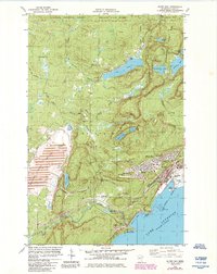
1982 Map of Silver Bay
USGS Topo · Published 1985About this map
Lake Superior shorelines define this 1980s landscape, where the industrial infrastructure of Silver Bay meets the managed wilderness of the North Shore. The map documents a significant era of taconite processing and transportation, centered on a massive Industrial Plant and an extensive network of Tailings Ponds connected by a dedicated Mining Railroad. These industrial footprints stand in sharp contrast to the established settlements at Beaver Bay and East Beaver Bay, which sit near the mouth of the Beaver River.
Find a feature on this map
50 named features on this map. Tap any name to fly to it.
Don’t see what you’re looking for? This feature index may not catch every label — zoom into the map to look around manually.
Map Details
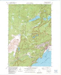
Editions of this 1982 Silver Bay Map
2 editions found
Other maps of this area

1954 · Silver Bay
USGS Topo · 1:62,500

1954 · Two Harbors
USGS Topo · 1:250,000

1956 · Split Rock Point
USGS Topo · 1:24,000

1956 · Finland
USGS Topo · 1:24,000

1956 · Finland
USGS Topo · 1:62,500

1956 · Illgen City
USGS Topo · 1:24,000

1956 · Split Rock Point
USGS Topo · 1:62,500

1956 · Split Rock Point NE
USGS Topo · 1:24,000

1957 · Two Harbors
USGS Topo · 1:250,000

1958 · Two Harbors
USGS Topo · 1:250,000