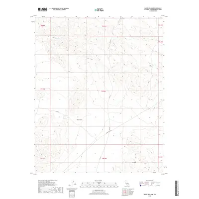
2018 Map of Silver Bell Mine
USGS Topo · Published 2018About this map
Silver Bell Mine serves as a primary historical landmark in this high-elevation corner of the Mojave Desert. The map reveals a landscape defined by sharp elevation shifts and steep drainages, most notably within the sheer walls of Box Canyon in the northern reaches and along the prominent Iron Ridge to the south. Human activity in this arid environment is largely limited to industrial and utility infrastructure, with the Transmission Line Rd and the Canyon Rte providing the only structured access across the rugged topography. Water is a rare and vital resource here, marked specifically at Sheep Spring, a point that often dictated the movement of miners and travelers in the high desert. This 2018 survey documents the persistent presence of mining claims and the sparse but critical network of desert routes that have shaped exploration in San Bernardino County.
Find a feature on this map
16 named features on this map. Tap any name to fly to it.
Don’t see what you’re looking for? This feature index may not catch every label — zoom into the map to look around manually.
Map Details
Editions of this 2018 Silver Bell Mine Map
This is the sole edition of this map. No revisions or reprints were ever made.
Other maps of this area

1953 · San Bernardino
USGS Topo · 1:250,000

1954 · Galway Lake
USGS Topo · 1:24,000

1955 · Silver Bell Mine
USGS Topo · 1:24,000

1955 · Sunshine Peak
USGS Topo · 1:24,000

1955 · Newberry
USGS Topo · 1:62,500

1955 · Lavic
USGS Topo · 1:62,500

1955 · Cady Mountains
USGS Topo · 1:62,500

1955 · Rodman Mountains
USGS Topo · 1:62,500

1956 · San Bernardino
USGS Topo · 1:250,000

1957 · San Bernardino
USGS Topo · 1:250,000